Whilst being from New Zealand and having a love of the outdoors, I had limited experiences of what I would consider as long-distance hiking. Maybe 30 miles would be about the furthest I had traversed in a single expedition. So when I announced to my closest friends that I was about to tackle the 2200 mile USA Appalachian Trail (AT), many of them rightfully laughed. I nervously laughed with them. What indeed had I set myself up for this time!
But to create No Rule Book, which centred around stepping out of one’s comfort zone, I had to be authentic. I had to literally walk the talk.
This crazy idea started when visiting a good ‘outdoorsy’ friend in Asheville, North Carolina. Whilst driving around and admiring the nearby Blue Ridge Mountains, Jock and I came across some hikers crossing the road ahead. Jock then proceeded to tell me about this famous legendary trail hike that starts in Georgia that runs all the way up the USA’s west coast, through 14 states, finishing on a remote mountaintop in Maine. Then and there we vowed that we would start this hike someday.
‘Someday’ however never came to Jock. I had other intentions and they weren’t to wait until ‘someday’. ‘Someday’ never comes. I fixed a year to at least start this magical feat of hiking so I locked myself in, with or without my USA friend. You just have to do what the Nike slogan says, and ‘Just Do It.
Back in New Zealand I hastily prepared all the quality gear I thought I would need and booked my 2017 flight back to USA to make my way to Springer Mountain, just north of Atlanta, Georgia. I purposely did the bare minimum of hiking research so as not to scare myself off from the immense challenge I was about to undertake. Spontaneity can sometimes be your best friend in such circumstances.
A funny thing happened in what would be my last interaction with civilisation for a while. Whilst visiting an Atlantabookstore this book cover jumped out at me. Now, I have had many coincidences happen throughout my life, and this is yet another one. The universe was talking to me in only the ways it can. ‘Do One Thing Every Day That Scares You’ Yes, I was nervous about this upcoming adventure. And yes, I felt very alive as a result. I was doing it!
A rather adventurous friend agreed to hike the 76 miles of the first state with me (Georgia), so brave Karen and I set off from Springer Mountain on a crisp Spring day in 2017.
The first stage of the trail is filled with many wanna-be hikers, who, just by seeing how they are prepared, obviously have no real intention of hiking through till tomorrow, let alone complete the Georgia section. The designated shelter and camping areas are full and noisy, so one must grit their teeth and punch on. Fifty miles down the trail and the crowds thin out enough so we could fully appreciate the surreal beauty of the oldest mountain range in USA. But Georgia is a tough hike, with no switchbacks (uphill zig-zags to make steep climbs easier), but as the days past we built up the necessary strong trail legs to make the going easier. For novice hikers, but adventurous spirits, this was living … until my knee started hurting from the 25kg weight of my pack over the rocky terrain. Thankfully, we pulled (or I limped) into the first of many Outfitter shops, where the experienced staff performed a ‘shake-down’ of my packs contents. I was well out of my comfort zone so any know-it-all attitude I might have previously possessed, was shelved, whilst I watched the expert perform his magic. One hour later, and 10kg lighter, I hiked away with the latest hiking poles, waving goodbye to two pairs of my favourite jeans, electric shaver and a battery powerbank – my knees were most thankful for that visit.
Lesson One – When out of one’s comfort zone, learn to swallow your pride and heed expert advice.
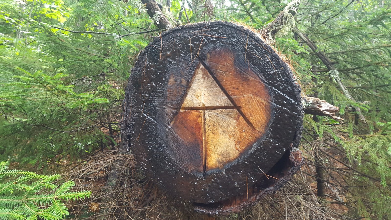
Our average miles per day started at 8 miles, but by the end of the week we were into double digit miles. I was also quickly learning the most-know coded markings that one needs to watch for to ensure you are indeed still following the AT. All hikers must look for white lines (some clearer than others) marked on trees, rocks or signs – these can be varying lengths apart, from 100 to 1000 feet, and there were many nervous times when I had not seen a marker for a while. These photo’s show what I mean. (oh, and blue markers signalled water) :
Double line right above each other – trail goes straight ahead.

Trail deviates left

Water
As we crossed the state line into North Carolina, I bade my intrepid friend goodbye and continued alone into North Carolina. This state, whilst not as brutal as Georgia, is much longer and has some very long mountain climbs, but you will be rewarded with some of the most wonderful vistas, for your troubles. There are some quirky towns to drop in to for resupply and for getting some much needed R&R, and sleeping in a real bed in a comfortable hotel. On the trail, you quickly appreciate many things you take for granted, especially when sleeping on a wooden floor of a shelter and getting your water from streams.
Lesson Two – Appreciate all things you take for granted – a warm comfortable bed, a solid roof over your head, clean drinking water from a tap, and the ability to buy any ready-to-eat food anytime, eating tasty burgers with lots and lots of salt. 😎
So into North Carolina I walked alone, even though when on the trail you are never really alone, This was highlighted when I had my first black bear encounter shortly after entering the Smokey Mountains, near Fontana Dam. Barely 30mins after entering the famous National Park, I rounded a curve to be greeted by a large mum and her cub, barely 150 yards away. I froze. It was then that mamma-bear saw me, and at that precise second, her cub clambered for safety up the nearest tree. She started a false-charge at me and so I backed off a crouched behind some undergrowth. For the next 10mins mamma-bear and I sat on our butts, watching each other, waiting for junior to clamber down from the tree. This bear encounter would be the first of approximately 25 bear (and beer) encounters I would have on the trail.
And so I hiked through the 70 miles of the Smokey Mountains whilst snaking back and forth between the 387 miles of Tennessee and North Carolina, visiting the lovely NC town of Hot Springs, where I took a couple of weeks off from the trail to visit some good friends living in Asheville. I think I spent the whole time there over-indulging on all things beer, pizza and burgers, before kicking myself back onto the trail to soon enter the long 540 mile Virginia section.
It was not many miles before Damascus that I had an interesting bear encounter. Having less than 1 mile earlier met some female hikers who were telling me they were disappointed that they had not encountered any bears, I rounded a corner to be greeted by 4 bear cubs playing on the trail, barely 20 meters from me. As a (now) educated hiker, I suddenly went into the ‘Where is Mamma Bear?’ mode. Funny thing, I need saw her. These cubs were sooo cute .. but this is such a dangerous situation so I was quite relieved when they scuttled into the undergrowth.
Entering Virginia the weary hiker is greeted with the ultra-friendly hiking town of Damascus. I don’t think this town would exist today, if not for the hikers who eat, drink, and party, before kicking back out onto the trail. I thank you, Damascus, for the boutique beers, loaded burgers, large pizza’s and the friendly vibe.
A highlight of the long, but very pleasant, hike through the 540 mile trail section that covers Virginia, is McAfee Knob.

The author taking a photo-op break on the awe-inspiring Mcafee’s Knob
This is the most photographed spot on the trail and it does not disappoint. Great vistas greet hikers and even a amateur photographer and somewhat reluctant selfie-taker, like me, can’t resist a photo op.
Another favourite of many a hiker is the 75 mile jaunt through the Shenandoah National Park. There is a high concentration of black bears within the park, and it sure did not disappoint me. It was halfway through the park that I had two spectacular, but vastly different, encounters.
Encounter 1 – Whilst admiring a vista with an American hiker-friend, we noticed many leaves falling from a tree nearby. But this was a still day with not a hint of even a breeze! Perplexed we looked up at the tree and saw a large cone shaped beehive. Hmm, but that still doesn’t answer for the falling leaves, we thought. Just then we saw the bear’s claw swatting at the hive and a precariously balanced bear straddling the branch holding the hive. Just at that moment we witnessed the swat that sent the beehive (and very angry bees) tumbling to the ground below. The bear jumped/fell/stumbled to the ground and proceeded to force his face into the hive to eat his fill of honey, whilst also being stung by countless bees. Watching at a safe distance, we felt like we were witnessing a real-life version of a Walt Disney comic. The bear diving his head into the honey, taking his head out to shake of the very pissed bees, then straight back into eating mode. This went on for a full 3 long minutes before the bear detected us and scurried away. It was only then that I got a rushed pic of the bears hasty exit. When I recall this story some people ask why I didn’t video it, or at least taken photo’s. But life isn’t to be lived through a lens in such moments. I was there and it was amazing and very spontaneous and took my breath away for all its innocent fun. We laughed so hard after the event and still chat about it to this day – a priceless lifetime memory.
Encounter 2 – This involved getting slightly lost and trying to locate the trails direction. I was reclining against a large tree whilst my hiker friend retraced his steps. It was then that the tree just, well … SHOOK! The next few seconds happened VERY quickly. A bear came hurtling down the tree, nearly crashing down onto my head, as it landed right at my feet and sprinted away.
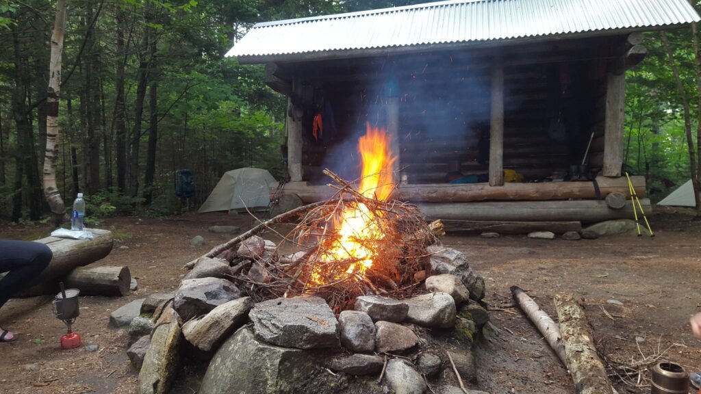
Since I was now well accustomed to life on the trail, I was also fast becoming used to sleeping each night in the 3-sided shelters that are scattered every 7 to 15 miles just off the trail. Sure you sleep on a wooden floor, and have your hiking pole at the ready in case of curious wildlife (namely bears), but at least it is a shelter from the rain. Most shelters even had a campfire.
 Next USA State up was West Virginia, and at only 18 miles in length, it is easily the shortest state to traverse through. The town of Harpers Ferry is known as the Appalachian Trail’s half way point … except … it is not. You have to carry on another 75 miles to reach the true half way point at Pine Grove Furnace. So after a couple of days stay in the lovely Civil War town, I continued to reach halfway after 3 months hiking and visiting many an interesting resupply town. Once at Pine Grove Furnace I stuck to my plan of having a break and picking up the trail again in 2 years. To a non-American, it made perfect sense to break it up into to even non-hurried adventures.
So, come 2019, nearing the time to restart my hike. I had two good friends say they would do it with me. Closer to departure date, they both pulled out for whatever reasons.
Lesson Three – Understand the Nike slogan – ‘Just Do It’ – don’t wait for others in life. Be strong to go alone if need be, and just do whatever your ‘IT” is. Otherwise you will be waiting your whole life.
I flew back to USA, and made my way to Pine Grove Furnace to pick up from exactly where I had left off. As expected the first few days back on the trail, were hard. Lugging a 15kg (33 pounds) pack up and down hills is tough, but after a few days the necessary leg muscles develop and then the hike turns largely into one of mental toughness. This contradicts common thinking that you have to be extremely fit. Sure, fitness helps, but I saw many a young fit and fast hiker give up because they focussed solely on the daily miles, over taking time for all the beauty all around. Thus many a fast hiker turns the experience into a huge chore, and this extreme monotony eventually breaks them down.
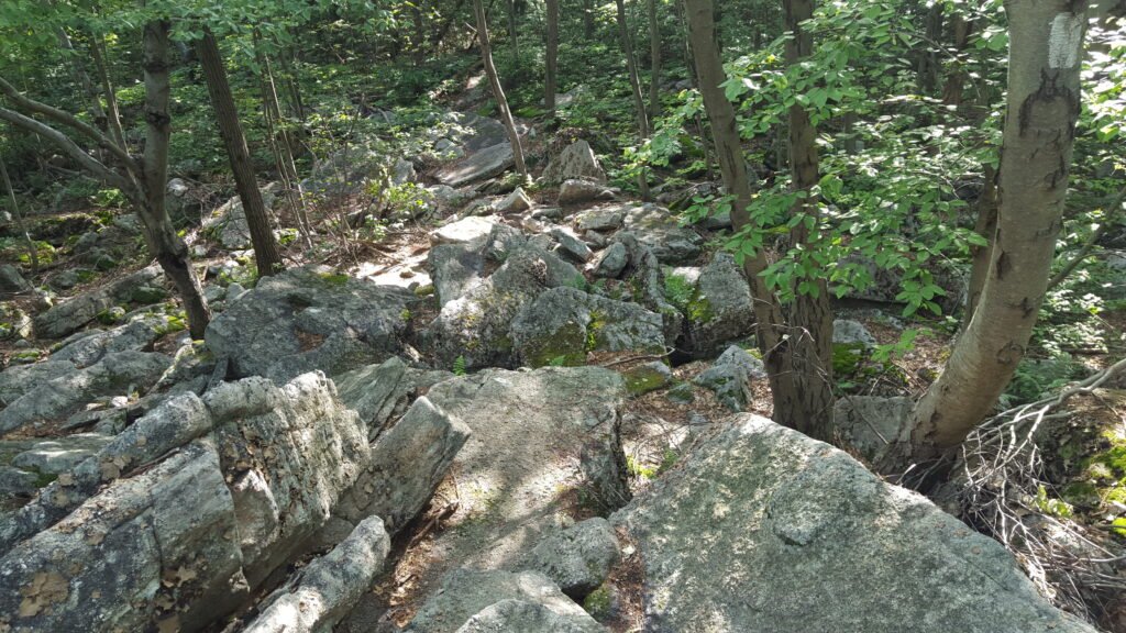
So out into the 40 miles stretch of Maryland I went, eventually crossing the Mason-Dixon line – the historical demarcation line between the South and the North. Soon after, I entered the 230 mile flat stretch of trail that makes up the Pennsylvania leg. Whilst flat, this part of the trail is dreaded by all hikers, because of one notorious word. ROCKS. It’s not that the rocks are big. Just that they are small and point upwards so are continually jabbing onto the nerves on the soles of your feet. All I wanted to do was walk whilst admiring the view,, but I was forced to continually look downward to ensure I didn’t twist an ankle. And then, as if by magic, about 3/4’s into PA the perils and pain of the rocks vanish and slowly the nerve pain subsides. Pennsylvania, just like every state on the trail, does however have many positives. The biggest was arriving in Duncannon, and staying at the famous (or infamous) Doyle Hotel. Originally wooden hotel built in the 1770’s, the current brick built replaced it in 1803 after a fire. Many a famous person, including Charles Dickens have bedded down here for the night. It is now a no-frills accomodation for the weary hiker, and serves great bar meals and cold beer. Contrary to what many hikers told me, I would say it is a must-stop-and-stay visit if you are to experience the true Appalachian Trail.
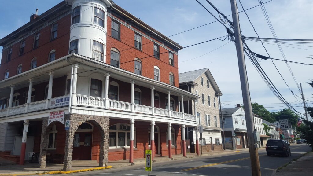
The Doyle Hotel – A must stay to say you have really completed the AT
Another curious thing I found whilst resupplying in a local Perry County supermarket was discretely pinned to their public notice board. Believe it or not, I was hiking through Sasquatch country!

Report your Bigfoot sighting whilst grocery shopping!
Leaving Duncannon, I crossed the Susquehanna River and make my way back into the wilderness where I didn’t plan to see civilisation again for the next 70 odd miles it would take to resupply at Port Clinton.
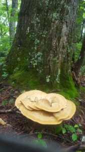
This part of the trail had some good climbs which made a good change from the rocky flatness of the earlier PA sections. On route to Port Clinton there were many outbreaks of ‘Chicken of the Woods’ – the edible bright-orange mushrooms that are seen growing on wet trees and logs. I never got up the courage (or appetite) to much down on any but they did make a nice photo. Similar hue to the countless orange newts found throughout the trail – you decide :


I wearily pulled in to Port Clinton and was really looking forward to a cold beer at the local Fire Brigade headquarters (yep, they have an on-premise pub). But first I had two important tasks -:
1/ Find a bed for the night, and
2/ Mail my tent away and thus lessen my overall pack weight.
Finding a bed was easy as the Port Clinton Hotel (on the main road) offered a great deal. So after throwing my pack in my room I took my tent to the post office, and after some hasty packaging it was time for a well-deserved beer (or five). Making the decision to mail me pack away was not made lightly. Sure I saved lost of weight, as it was a 2-person tent, but now I was dependant on finishing each night at a shelter, or the only option was cowboy-camp (sleep under the stars). My knees made the decision for me, as they were groaning under all the extra weight. With the decision now made, I savoured the lovely Fire Station beers. Next morning I had the memorable experience of getting my hair cut at the only musical-hairdressers I had ever been to – The Port Clinton Barbershop. What a treat! Free coffee, donuts and impromptu live music whilst getting your hair cut whilst draped in an American Flag sheet. Anyone that hiked the AT without dropping in to visit Frank and get one of his $12 haircuts.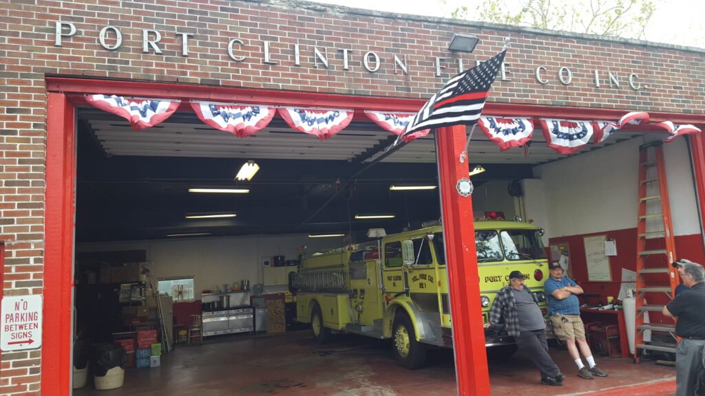

Author getting the typical hikers shave cut (with live music)
Two days of fun in town and I was once again back on the trail. Now, there’s a good reason why most hikers don’t stay longer in these fun towns. You get such good muscle conditioning in your legs from hiking the mountains so you can’t afford to go back to square one. Best to kick yourself back onto the trail whilst you still have optimal power. It was hard leaving the fun of little Port Clinton, but northward I headed.
It was only a few miles into the nearby mountains that I rounded a corner and nearly stepped on a rather large porcupine. This was my first encounter so I was fascinated as it slowly scampered away like an old man. An experienced hiker told me they climb trees very well, and, contrary to popular folklore, they can’t throw their quills. It was such a treat to have such a close encounter!
40 miles later and I was dragging myself up to the top of Lehigh Gap. This was a rock climb not for the faint-hearted or anyone that might be afraid of heights. Great view from the top though!

The brutal rock climb called Lehigh Gap
After 40 miles more of Rocksylvania ( as PA is affectionately called) I arrived for a resupply and welcome bed at the local church that has been converted to a hikers hostel. Sure is good sleeping in a comfy bed after nights and nights on the wooden floor of. a 3-sided shelter (refer ‘Lesson-Two’). Nice food in this town and even a BBQ-smokehouse where I enjoy some delicious, and much-needed protein (and beer).
Crossing the Delaware River I enter the 72 mile New Jersey section of the trail.
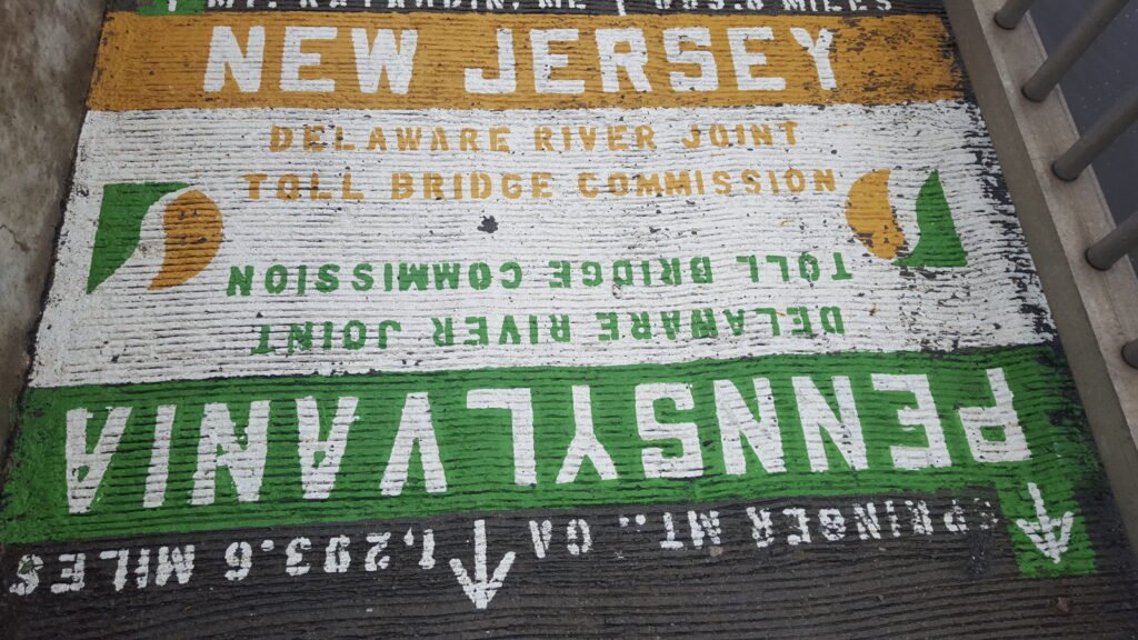
Goodbye PA. Hello New Jersey!
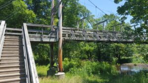
I was told by SOBO’s (Southbound hikers), that New Jersey had lots of boardwalks and a few interesting bridges. It didn’t disappoint. New Jersey had a lot of variety.

NJ also had quite a few rocky cliffs so I worked my way gingerly over them. On a hot sunny day you have to be careful when making your way over rocky clearings, as it is a favourite place for snakes to bask in the sun. And sure enough, it wasn’t long before I got my first warning from a very thoughtful rattlesnake, rattling its tail at me so advise that I was way too close for its liking.
Who was I to argue?

Thanks for the warning, Mrs Rattlesnake
Needless to say, I quickly (and quietly) hiked onward.
Soon after this ‘rattler’ encounter I would have quite possibly, my most scary beer encounter. To explain – A ranger told me that 90% of the time a bear will detect you and run away. The other 10% is when a bear hides and hopes to remain undetected as you go past unaware of their presence. Well, on this particular sunny day, I was in a very relaxed mood, enjoying nature, as I ambled up a gentle hillside in the forest. As I walked past some low bushes, my heart-rate suddenly (and I mean split-second suddenly) went from normal to panic mode, as a bear, taller than my 6ft+ self) erupted from the bushes. He was standing upright, looking down at me, and I think we both were petrified. There was a loooong few seconds of looking at each other, wondering what would happen next – he was close enough to swipe out and potentially take off my head, and i was close enough to prod him with the only ‘weapon’ I had (my hiking pole). Then, just like that he crashed back into the safety of the dense forest. I slumped over my hiking poles trying to gasp for air. As my heart beat returned to normal I was overcome with exhilaration – this is living – this is what I spend time in nature for!
And so I entered Appalachian Trail State # 9 – New York State. Crossing the Hudson River I soon started chipping off some of the 93 miles that this state covers.
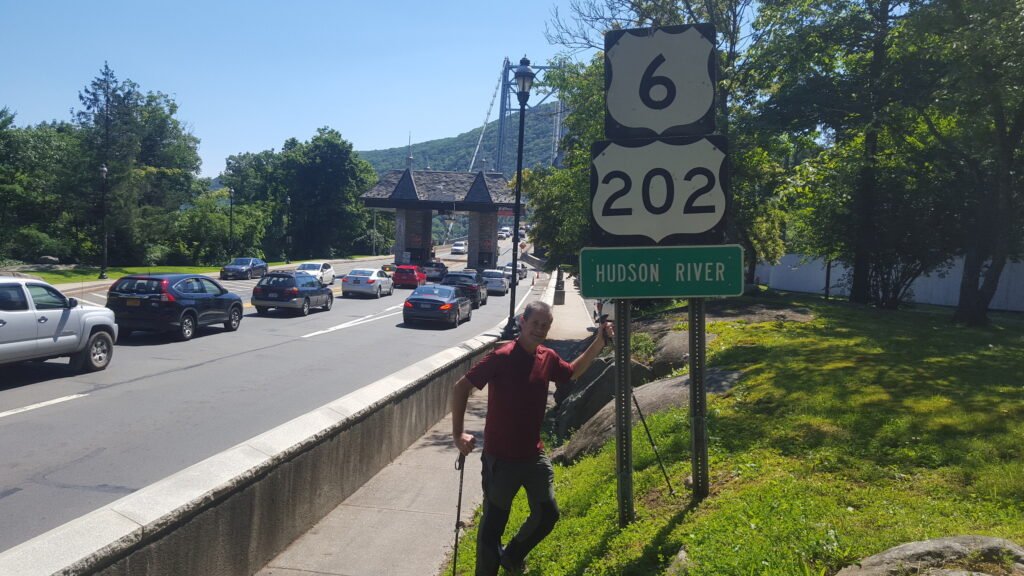
The Author crossing the mighty Hudson River
Somewhat bizarrely, the trail goes directly through an actual zoo, before I found myself tackling some steep climbs to eventually get to the the of Bear Mountain, and glimpse the New York skyline in the distance. From this point, for the next several miles I was hiking along a clifftop ridge line. My aim was to sleep at the next shelter on the trail. but I missed the trail turnoff, and it wasn’t until a mile later I realised. I wasn’t about to backtrack, and add 2 miles to my journey (or approximately 40mins on the rocky terrain), so I opted to ‘cowboy camp’ on the clifftop, instead. So I hunkered down, under the stars, with the small tarpaulin I carry just for these occasions, under my air-mattress, to protect it from being punctured. And then it rained. Hurriedly I pulled my tarpaulin on top of me to protect me from getting saturated, and preceded to spend a rather sleepless night staying dry and ensuring I didn’t roll off the clifftop. After a 6am sleep-in I was back hiking northbound.
The next adventure would be affectionally known as ‘The Lemon Squeezer.’ A very tight-to-negotiate rock shuffle every hiker has to do to successfully negotiate this section. Every so often on the trail, there will be an obstacle, be it a rock wall, dangerous mountain ledge, vertical drop, that you need to pause in front of. You then work out in your mind, much like you would a puzzle, what could be the best way to negotiate the obstacle. The Lemon Squeezer was one such puzzle. Do I take off my pack, to make myself thinner? Do I go over or through the gap? Decision made, and after an hour, and much squeezing, I was through and back hiking.
Further up the trail, after a night spent camping on a monastery ball field (of all things), and eating and drinking my fill at a convenient (but rare) trailside deli, i exited new York State to enter State #10 – Connecticut, where I would have yet another very unique. and somewhat scary experience.
Connecticut is only 50 miles long for hikers but it sure punches above its weight in the scenic beauty it packs into those miles. I enjoyed the somewhat gentler terrain and was looking forward to soon spending a few relaxing recovery days in Salisbury, staying in a nice hostel I had advance-booked, and eating the local pizza that many hikers had raved about. Plus I was due to meet an earlier hiking buddy who said he would join for a week’s hiking. All that would stand in the way of all this would reveal itself barely 10 miles from town.
I was making good steady progress keeping to my now average daily mileage of approximately 17 miles a day when I came to a lovely sunny clearing. Perfect for a break where I could perch on a nearby rock, eat some lunch (normally comprising of Cliff energy bars) and take in the view. This is how to hike the trail – exercise in the outdoors whilst still taking lots of time to smell the roses and enjoy nature all around. As I was basking in the sun, enjoying the glorious vista in front of me, that I felt something was sharing the moment with me. I gazed down and to my horror there was a skunk sniffing my feet.
Now, skunks are gorgeous fluffy animals. Bigger and fluffier than a cat, they have a gorgeous thick black and white coat with a bushy tail. But that’s not what they are famous for. It is their very effective defence mechanism that strikes terror in EVERY living soul in the woods. A skunk can spray a hapless victim with a high level of accuracy, even from 3 meters (10 feet) away. Needless to say, I was well within range. It was common knowledge that if a hiker got sprayed the smell prohibited the vicim from entering civilisation (ie, the next town which happened to have highly rated pizza) until the repulsive smell subsides. Normally with 4-5 days! To a malnourished hiker hanging for a cheesy XL pizza and XXL cold beer, this was not an option.
So I froze like a rock.
I have never ever been so still in my life. I was so motionless, not even daring to make any noise. I can’t even display any photo of the incident here, as I purposely took no photo’s – such was my fear that even my smartphone’s shutter noise would trigger a calamity of the utmost proportions. I stayed as transfixed as a rock for at least 10 minutes whilst the skunk sniffed around me not realising he had absolute control over whether I would have beer and pizza tomorrow. A full 10 minutes, that seemed like an hour, passed before Mr Skunk, and now his girlfriend, finally scurried into the undergrowth. I waited a few minutes more before I crept onward. The next day, at dinnertime, I dedicated that delicious beer and pizza to my black and white friend.
My good friend had now arrived in town to join me for a couple of weeks on the trail. Jeff was an experienced hiker having thru-hiked the entire Appalachian Trail two years earlier. There was no question about his fitness and stamina to last a mere two weeks. Or was there?
After days of much needed R&R, we left the quant town of Salisbury and hopped back onto the trail. The next two days of terrain was hilly to mountainous, with a few rock climbs. Nothing too outrageous so no cause for concern. But during the day I noticed that Jeff was faltering, and by the days end he literally collapsed in front of me at the campsite. Jeff reassured me that he would be fine and ready to go after a good nights sleep, but, despite a slower hiking pace, he was no better.
“I think I will have to go back to Salisbury. I can’t go on.” Jeff uttered after Day Two.
Who was I to argue, as he was very experienced at all this and knew he just not was at the physical level required, having been off the trail for too long. We discussed the options and came to the same conclusion. He would slowly hike the two days to Salisbury to retrieve his car, then message me to say all ok.
This incident highlighted something that many long distance hikers have discussed. There is an approximate one week period at the start of hiking where your body is jolted into condition. Due to climbing the constantly mountainous terrain, whilst also carrying a 15kg (33 pound) pack on your back, your legs literally turn to steel, whilst your arm muscles, since they aren’t working nearly as hard, whither away. Long distance hikers jokingly refer to this as the ‘Tyrannosaurus Rex Syndrome.’ If you can picture what it looks like you get the hiker image.
Jeff messaged to say he was driving back to Maryland and I said I would visit after my hike’s completion. The Katahdin Mountaintop finish was still about 700 miles away so I had to press on . I soon entered the 90 mile stretch that makes up the State of Massachusetts. State #11.
Many hikers talk about the 3491 ft (1063m) summit of Mount Greylock as the highlight of the state, offering dramatic views in all directions for over 60 miles. But for me, the highlight was detouring a mile off the AT trail (remember 1 mile equals two miles, in total) to hike to Upper Goose Pond Shelter. As with all shelters on the trail, this is a first come first ‘served’ shelter, and when I arrived it already had a dozen hikers there busy recuperating and exchanging stories. The shelter was more like a house and even had a lovely lake right in front. People would pay big dollars for a holiday here, so I made up my mind to stay two nights and soak up the atmosphere and comradery. Now contrary to what many less-travelled people may think, American’s (just like many others in this glorious world) are friendly generous people, and this was evident when a lady living nearby in her holiday home, turned up in her boat with one dozen pizza’s and several dozen beers. She explained that she randomly does this to help the malnourished and wea
ry A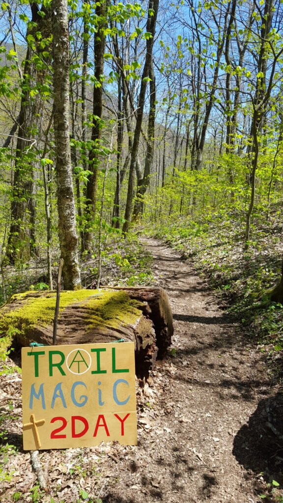 T hikers. It felt like Xmas. Such kindness is also experienced when, whilst crossing any random road, you may encounter people giving away drinks and food to hikers, wanting only stories in return. There is a trail name for this random event and it’s people – The occurrence is called ‘Trail Magic’ and the people are called ‘Trail Angels.’ And believe me, when they are Angels. Many a time I stopped for half an hour and sat, chomping on a sandwich whilst simultaneously necking a sugary-sweet soft drink, whilst chatting about my native country or the AT adventures I had experienced thus far. Such kindness, never expecting anything in return, is very touching and restores one’s faith in humans.
Reluctantly kicking myself out from the comforts, and calorie-laden foods, that Upper Goose Pond shelter kindly provided, I hiked northward and soon entered State # 12 – Vermont.
Compared to many of the past states, and the renowned-tough states ahead, the 150 miles of Vermont were a welcoming ‘peaceful’ hike. No gut-busting climbs and no death-defying cliffs. Whilst it was, by no means, a ‘walk in the park’ is was, a kind of ‘hike in the park.’
Vermont brought with it another rather unexpected touching moment, that provided further insight into the mindset of many of the thoughtful and kind people I encountered on the trail. Half way through this glorious State, I ventured off the trail and proceeded to catch a road into a nearby town to resupply and get some much needed creature comforts we all take for granted, like a bed, calorie-rich fast-food, and running tap water to drink. Ohh, the luxuries. 😎
Manchester, Rutland has a very friendly hiker hostel where I stayed a couple of days with some hiking comrades. The owners asked each hiker about where they were from and all the regular chit-chat that goes with it all. When I woke in the morning, and stepped outside, I was greeted by my country’s flag flying proudly in the breeze. The owners had taken down their USA flag to put my flag (the most distant lodger’s flag) aloft. The fact they even had my flag was amazing in itself. Being so far away from home, I was touched at this simple act of kindness. (and still am, when I think about it).
Hiker Hostel flying USA flag

New Zealand flag flying in Vermont
I arrived in Rutland to stay at a rather interesting ‘hotel’ – A commune-style accomodation provider, where the workers give up everything they own and inter-marry, and living in their harmonious community. Not really my thing, I didn’t attend any of their ‘workshops,’ instead choosing to explore the lovely town. Still a few fun beer were had and got a haircut at a very old-skool hairdressers.
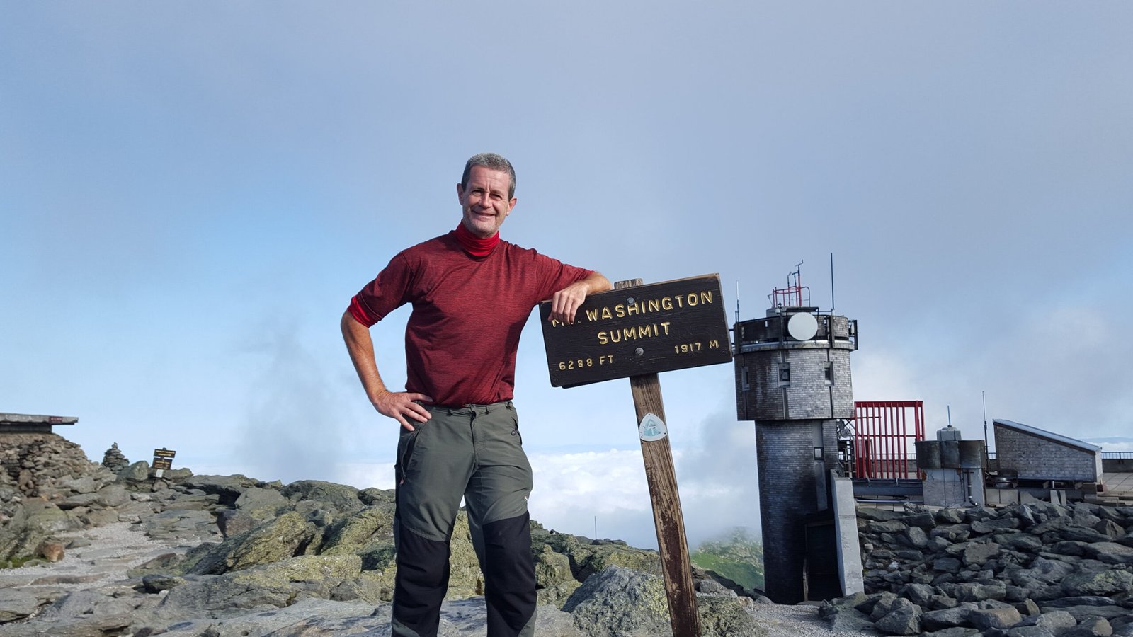
My good friend, Mount Washington
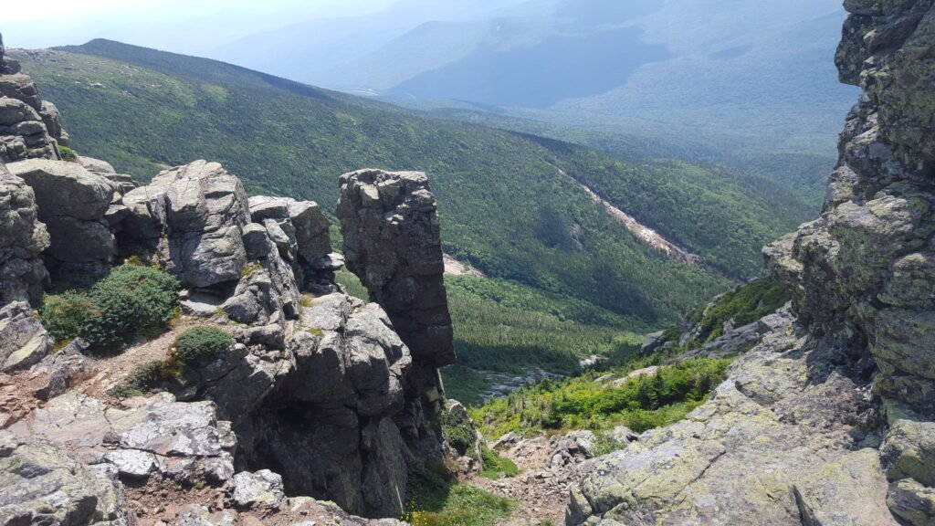
Tight squeeze through one of the many rock gaps to negotiate
Eventually I made it to Speck Pond Shelter and the this rewarding sight – Speck Pond.

Speck Pond in all its glory
This photo encapsulates part of the greatness the trail can bring. Meeting fantastic people that you would not get the chance to meet otherwise, and sharing a passion for the outdoors and all that is good in life. Cheers to that!
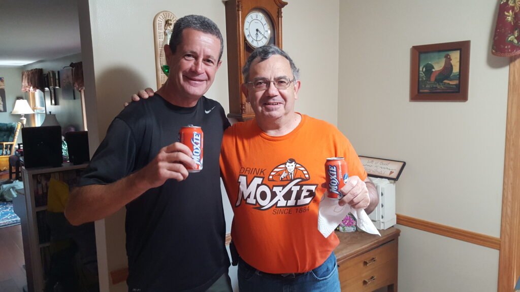
Drink Moxie .. since 1884
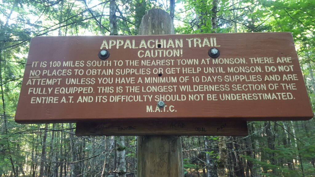
You know it is serious when there is a warning sign!
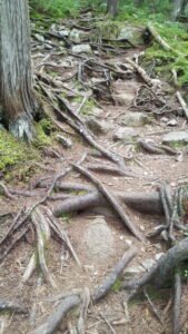
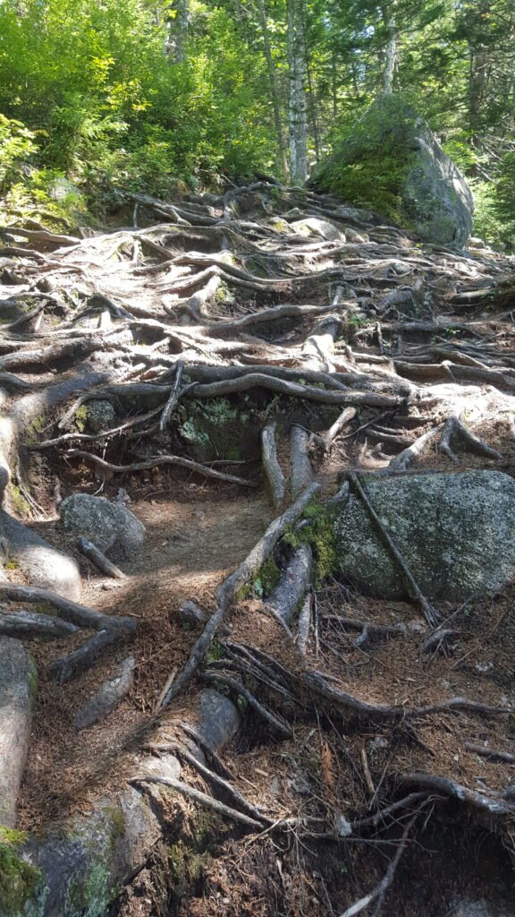
What did make the going tough in the 100 mile wilderness, more so than the endless hill climbs, were tree roots. Underfoot, the terrain was very treacherous with many opportunities to twist an ankle or rip a hiking shoe to shreds.
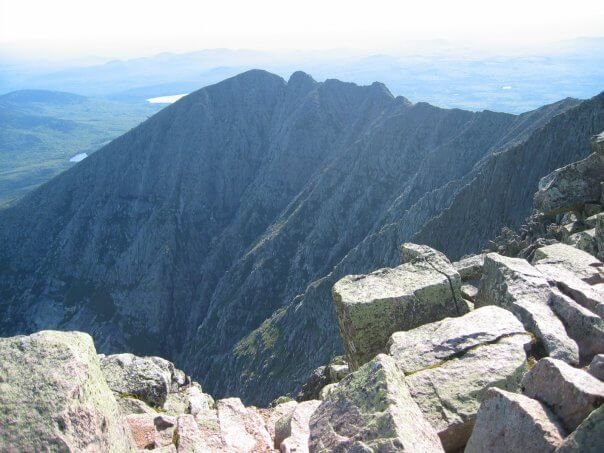
At 5269 feet (1606 meters) high, Katahdin isn’t the tallest peak on the Appalchian Trail, even though it is the highest mountain in Maine. The North American Indian translation for Katahdin is ‘The Greatest Mountain’ so all hikers respect the climb. The treacherous rocky climb to the summit deserves it.
I awoke early in the morning for my last day on the Appalachian Trail. All eager to set off and start the days hike up and over Katahdin. It was a cracker of a sunny day too.

2200 miles hiked!
Next morning I weighed myself before I ate the biggest burger I could find in the town. At the start of the trail I was my standard 185 pounds (84kg’s). At the end I was just exactly 154 pounds (70kg’s). That’s 31 pounds or 14kg’s!. Now I’m not saying long-distance hiking is a great way to lose weight, because most hikers leaving the trail soon gain the weight back. It’s the lifestyle changes that get the results and keep the weight off permanently.
The Fourth and Final Lesson the trail taught me was how amazing the human body really is. Within the first two weeks of the hike I could literally since my belly-fat shrinking as my body needed to get energy from somewhere. Once gain I had to ensure I did not get into calorie-deficiency, hence why most hikers carry calorie-rich peanut butter. Also, seeing my thighs gain the necessary muscles to carry myself and the extra weight was equally fascinating. Our bodies are our temple and to this day I keep hiking and staying in reasonable shape.
So after 2200 miles walked and 7 pairs of worn-out hiking shoes my mission was complete.
Thanks AT – I miss you already. 😎